
The haze is back! Oh dear. This was the view that greeted us this morning when we'd reached the top of the Jejawi Tower at Chek Jawa. Much of Pulau Tekong is obscured by the thick haze, and we can't even see the hills of Johor beyond.
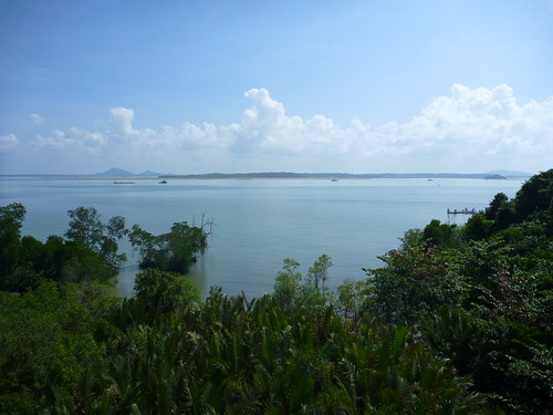
This photo, taken in 2010, shows what we usually get to enjoy on most days.
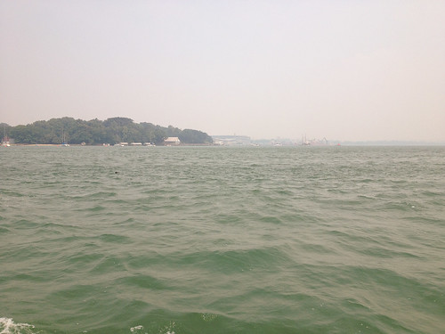
At the end of the walk, while resting at the Information Kiosk, we could detect a faint burning smell. The haze was still visible over Changi as we headed back to mainland Singapore.
It turned out that the whole of Singapore was affected, as people all over the island shared images of the view from their homes and offices. The 3-hour PSI at 7 pm was 82, which is still within the Moderate range. Let's just hope that it clears up over the weekend.
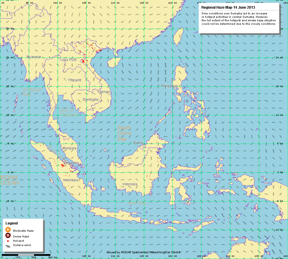
This is the Haze Map for today, 14th June (Click to enlarge). You can see the hotspots in Sumatra, and the winds that are blowing the smoke from these fires across to Singapore and southern Peninsular Malaysia;
(Map by Meteorological Service Singapore)
Do also note that the full extent of the hotspots and spread of haze could not be accurately observed by the satellites used to detect them, due to cloud cover. So in reality, things could actually be worse.

Here's a closer look at the hotspots in Sumatra, as detected by the NOAA-18 weather satellite run by the U.S. National Oceanic and Atmospheric Administration (NOAA);
(Image by Meteorological Service Singapore)
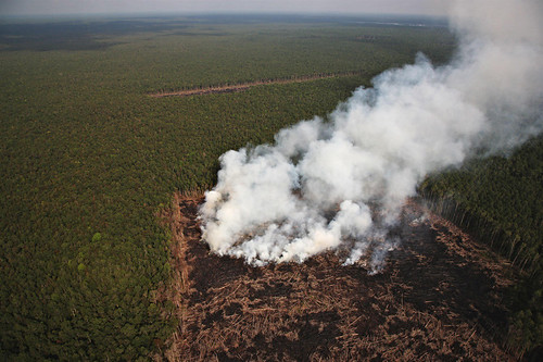
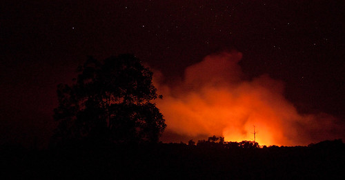
And this is what a hotspot possibly looks like from the air:
![Sumatra burning forest courtesy of Kim Worm Sorensen]](http://farm3.staticflickr.com/2577/4184066075_0276daff78.jpg)
Burning forest on Sumatra;
(Photo by Kim Worm Sorensen, from Inter Press Service News Agency)
Smoke from man-made forest fires in the Giam Siak Kecil-Bukit Batu area;
(Photo by John Novis, from Greenpeace International)
And if you think it's bad here in Singapore, I can't even begin to imagine what it must be like at ground zero.

Sumatra's Tripa forest going up in smoke;
(Photos by Rainforest Action Network)
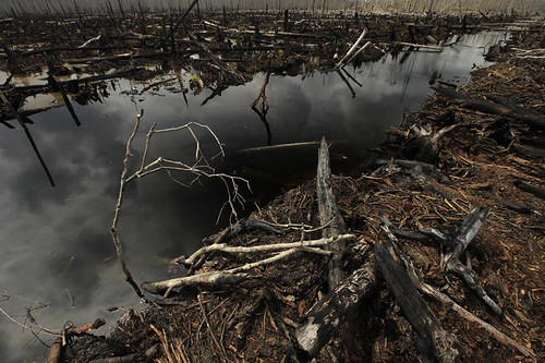
Destroyed peat swamp forest outside the village of Teluk Meranti, Kampar Peninsula;
(Photo by Kajsa Sjölander, from Greenpeace International)
The haze here is a very clear example of a transnational environmental problem. Pollution does not respect a country's political boundaries, and hopefully, with increased collaboration between Indonesia and the rest of the ASEAN member-states, this issue will be eventually resolved. After all, it's not just the wildlife and forests that are being affected by this, but millions, if not billions of people throughout the region whose health relies on clean air. I don't have any serious respiratory issues, but I don't think it's a good idea to head out for a run tonight.
But why are the forests being burnt? And how might our consumption patterns possibly be contributing to the destruction of rainforests in neighbouring countries? That's a story for another time.
I'm suddenly reminded of a song...
(Cross-posted to SBA Plus. Do support me in the Singapore Blog Awards!)